Reynolds County 35
000 State Highway 72, Bunker, Missouri 63629
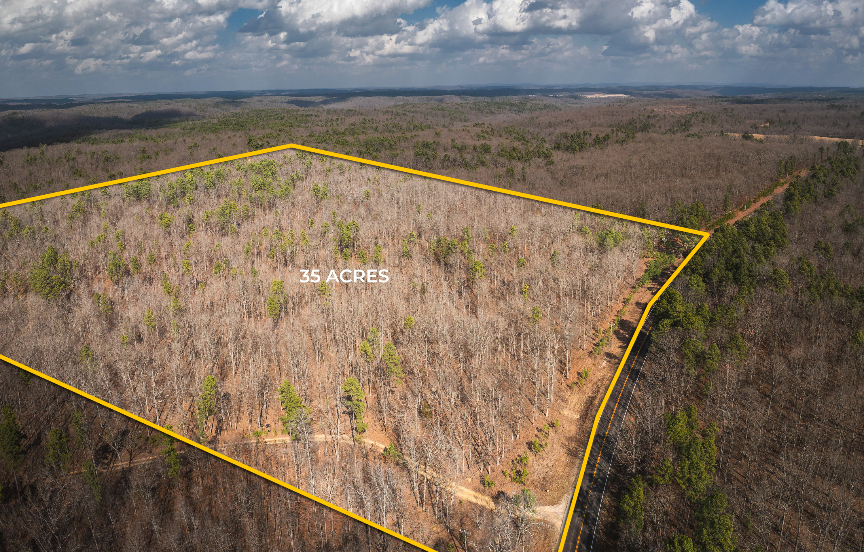
Bordering over one thousand acres of Mark Twain National Forest, this Reynolds County Missouri land offers rolling terrain, hardwood oak forest and electricity is readily available for your weekend cabin or new home. Located about two hours from downtown St. Louis, one…
- Electric Available
- View
- Timber
- Bedrooms
- Bathrooms

About This Property
Bordering over one thousand acres of Mark Twain National Forest, this Reynolds County Missouri land offers rolling terrain, hardwood oak forest and electricity is readily available for your weekend cabin or new home. Located about two hours from downtown St. Louis, one hour from Rolla, thirty minutes from Salem, and lies just east of the little community of Bunker, Missouri. The property…
Read Full DetailsAbout This Property
Bordering over one thousand acres of Mark Twain National Forest, this Reynolds County Missouri land offers rolling terrain, hardwood oak forest and electricity is readily available for your weekend cabin or new home. Located about two hours from downtown St. Louis, one hour from Rolla, thirty minutes from Salem, and lies just east of the little community of Bunker, Missouri. The property borders State Highway 72 providing easy access. A forest service road provides access to the northwest corner of the property, offering the possibility of establishing a base camp at the northern border of the property where it joins the National Forest.
Wild Turkey and Deer are plentiful; you won’t have trouble filling your landowner tags. An additional 32 acre adjoining property is available for purchase.
Be the first to view by calling Danny Miller at 573-528-1489.
At a Glance
Property Details & Features
Basic Details
- Status
- Sold
- Property Type
- Recreational
- Price
- $103,250
- Acreage
- 35 Acre
- Listing ID
- 6194
Features
- Bedrooms
- 0
- Bathrooms
- 0
- View
- Yes
- Timber
- Yes
- Electric Available
- Yes
Address Map
- Street Number
- 000
- Street Name
- State Highway 72
- Country
- US
- State
- MO
- County
- Reynolds
- City
- Bunker
- Zipcode
- 63629
- Longitude
- W92° 51' 18.4''
- Latitude
- N37° 25' 35.6''
Neighborhood
- Shopping Center
- 30 Minutes
- Hospital
- 30 Minutes
- Police Station
- 30 Minutes
- Airport
- 90 Minutes
- School
- 15 Minutes
- University
- 60 Minutes
- National Forest
- 5 Minutes